Things to do · Pickering, Ontario
Published
Seaton Trail in autumn: pick an access point before the hike
Pickering’s Seaton Hiking Trail runs 12.7 km along West Duffins Creek. The city describes steep bluffs, tricky climbs and varying difficulty. Use a listed access point such as Whitevale Park and plan a shorter out-and-back if you do not want the full route.
Facts checked
In this story
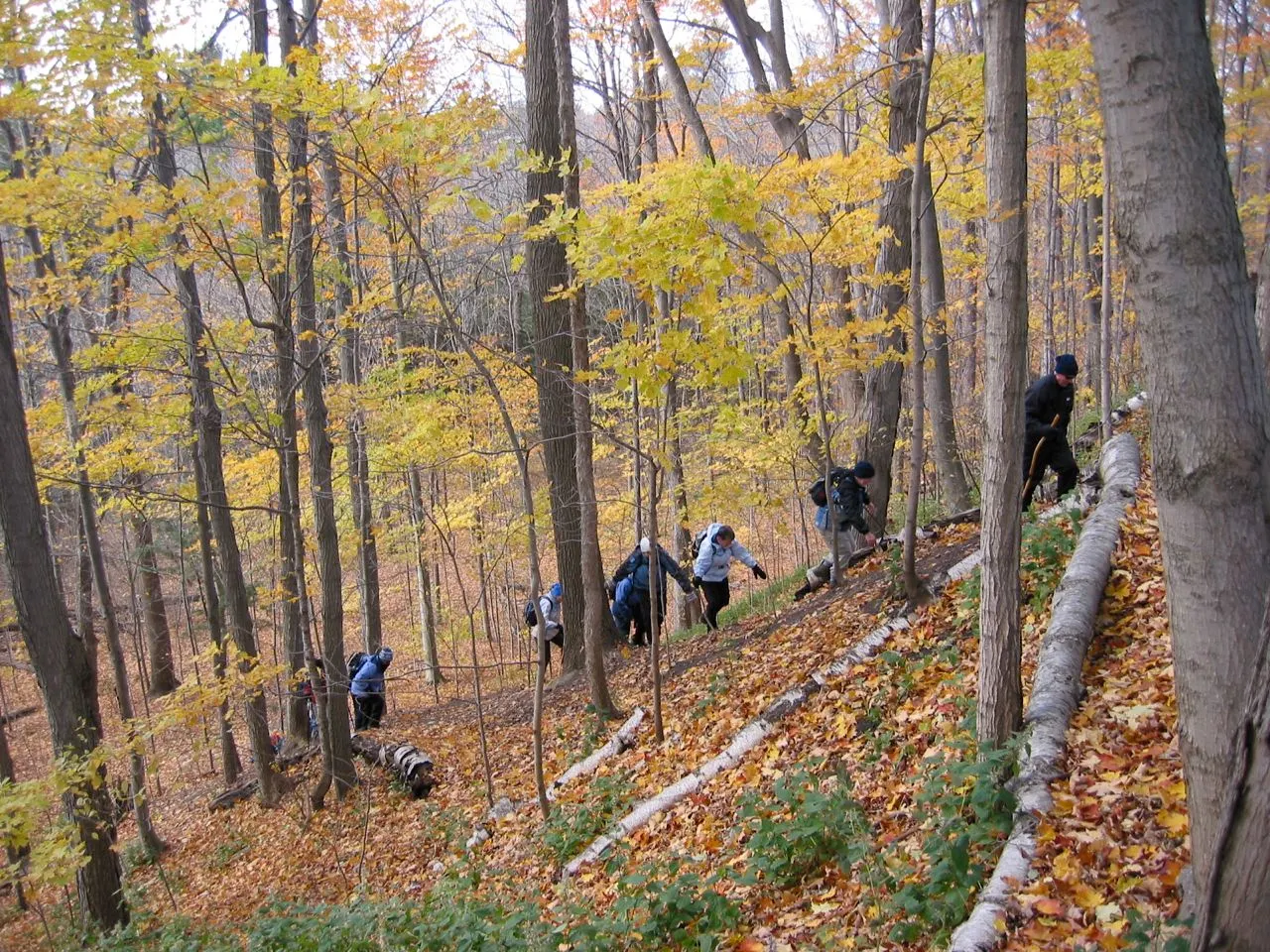
Choose one entrance and one manageable piece
Seaton’s 12.7 km route follows West Duffins Creek through climbs and changing ground. You can enjoy a piece of that valley without setting out to finish the whole trail. Pick one official access point, tell everyone where to meet and leave enough daylight for the return that your group actually wants to make.
Source: Pickering: trail uses, routes and access
What the community suggestions show
The October 2023 fall-trail thread liked paths near Duffins Creek and Grand Valley, while other replies suggested dirt paths and routes in nearby cities. The July 2024 newcomer discussion also named Seaton and a Church Street approach. These suggestions show that access points matter. They are not one continuous, easy route for every walker.
Choose the starting point before arranging a lift or meeting friends. Seaton is a named hiking route with several access points, not one single entrance that everyone will find automatically. A valley walk can feel much longer if you finish at a different road without a ride back.
Source: Pickering: fall trails and neighbouring alternatives, October 24, 2023
Source: Pickering: newcomer trails and local suggestions, July 13, 2024
Source: Pickering: trail uses, routes and access
Make the walk fit the available daylight
Read the city route description and map before leaving. Pick a section, decide when to turn back and allow for stops. A trail beside a creek is not the place to improvise a crossing or follow a path around a flood barrier.
For a first visit, returning the same way is easier to manage than a complicated connection. Keep shoes and clothing suited to natural ground. This is a hiking choice, so do not promise stroller access based only on a line drawn on the map.
Source: Pickering: trail uses, routes and access
The limits to keep visible
The city lists Whitevale Park on Whitevale Road and Foreststream Drive east of Whites Road among its access points with parking. The 12.7 km route follows West Duffins Creek through steep bluffs and changing grades. Choose a section before setting out, especially after heavy rain.
Source: Pickering: trail uses, routes and access
Seaton access and terrain
| Detail | City information |
|---|---|
| Length | 12.7 km |
| Waterway | West Duffins Creek |
| Terrain | Steep bluffs, climbs and varying difficulty |
| Whitevale access | Whitevale Park on Whitevale Road |
| Foreststream access | East of Whites Road |
Source: Pickering: trail uses, routes and access
The entrance changes the outing
The June 2024 parks thread described several ways into Seaton, including an approach near Whites Road and a wooded section toward the creek. It also warned that a pleasant weekend could be busy. Another commenter liked biking but felt a connected Whitevale route was less well maintained. Those are dated personal experiences, not a current inspection. They reinforce why it helps to choose an official access point instead of treating every informal path as the same hike.
The city’s main access list includes Whitevale Park, Foreststream Drive east of Whites Road, Grand Valley Park and Highway 7 in Green River. A group starting from different ends can accidentally plan two different walks. Share one starting point and the return arrangement with everyone. For a first outing, a section that you retrace is often easier to manage than arriving at another road and discovering the lift is still back at the original parking area.
Source: Pickering: parks, trails and different access points, June 1, 2024
Source: Pickering: newcomer trails and local suggestions, July 13, 2024
Source: Pickering: trail uses, routes and access
Twelve kilometres is a route length, not a target
The official 12.7 km trail follows West Duffins Creek, with steep bluffs and changing difficulty. That makes the valley interesting, but it also means the distance alone is a poor guide to effort. A short piece with climbs can take longer than the same distance on a flat path. Leave room for pauses and decide the turnaround before tiredness makes the decision for you.
If the group wants a gentle chat rather than a challenging hike, say that when choosing the route. Do not promise stroller access from a map line or from a photograph of one flat section. Choose shoes for natural ground and respect any barriers after rain or work. The appeal of a creekside walk is being able to notice the setting at a comfortable pace. You do not need to follow every side path or finish the whole named trail to enjoy it.
Source: Pickering: trail uses, routes and access
Place details and map
Seaton Hiking Trail, Whitevale Park access
Whitevale Road, Pickering, ON
An access point for a hiking route through the West Duffins Creek valley. Not a promise of a paved, flat or winter-maintained route.
Source: Pickering: trail uses, routes and access
More place details
Source: Compare these places in Resources
Source: Pickering: fall trails and neighbouring alternatives, October 24, 2023
Questions people ask
How long is the Seaton Hiking Trail?
The city lists 12.7 km along West Duffins Creek. A short out-and-back avoids committing to the full route.
Source: Pickering: trail uses, routes and access
What official access point is named?
Whitevale Park on Whitevale Road.
Source: Pickering: trail uses, routes and access
Can I access Seaton Trail from Foreststream Drive?
Yes. The city lists Foreststream Drive east of Whites Road as an access point with parking.
Source: Pickering: trail uses, routes and access
Which creek does Seaton Trail follow?
West Duffins Creek.
Source: Pickering: trail uses, routes and access
Is Seaton Trail flat?
No. The city describes steep bluffs, tricky climbs and changing difficulty. It is not a simple level strolling route.
Source: Pickering: trail uses, routes and access
What is a simple first-visit plan?
Choose one access point and a section you can retrace.
Source: Pickering: trail uses, routes and access
Should I count on a ride at a different exit without arranging it?
No. Set the return plan before starting.
Source: Pickering: trail uses, routes and access
Can I cross a creek to avoid a closure?
No. Stay on the open permitted route.
Source: Pickering: trail uses, routes and access
Is Highway 7 in Green River a Seaton access point?
Yes. It is one of the city’s listed main access points with parking.
Source: Pickering: trail uses, routes and access
Where is the Grand Valley Park access to Seaton Trail?
The city lists Third Concession Road west of Valley Farm Road.
Something changed? Tell us about a correction.